FIELD OF WORKS
BATIMETRIC - HYDROGRAPHIC SURVEYS
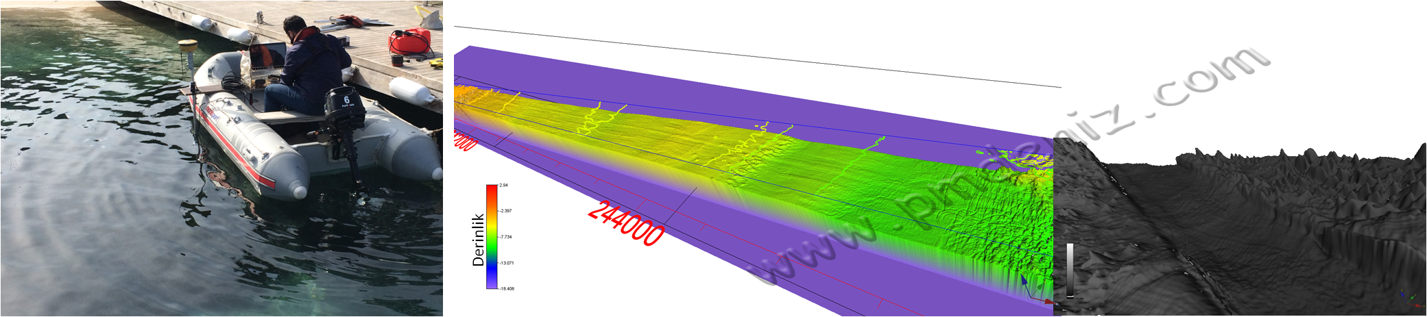
›
In order to determine the seafloor depth and morphology,
- Singel Beam Echosounder sounder
- Multi-beam (Mulibeam Echosounder) Sounder
- Real-Time Kinematic and Global Positioning Systems
use batimetric Map showing the sea floor map using IHO standards.
Changes in the tide level are measured to make the surveys precisely and to connect to the national Datum. After the necessary corrections are made, the bathymetric maps are prepared in 2D in CAD environment and 3D sea floor morphology is revealed with special software.
APPLICATION FIELD
- Preparation of Port Depth Maps
- Hydrographic surveying for Facilities Extending Beyond the Coast
- Surveys for Port Pile Construction and Control of Off-Shore Constructions
- Mapping of rivers, streams and dam territories
- In-Port Scan Control and Cubic Calculations
- Preparation of bathymetric maps of 1 / 500,1 / 1000 or 1/5000 scale in river, lake and seas
SOME EXAMPLES FROM OUR WORK
- Golden Horn Tube Crossing Project Preparation of Bathymetry Map with Multebeam, 2015
- D Hotel Maris Yachting Docking Stations Preparation of Bathymetry Map and Hydrographic Survey Raproun, 2015
- Preparing Demre Mega Yacht Harbor Bathymetry Map and Hydrographic Survey Raproun, 2012